Ground Water Exchanges & Hydrology

This is how you could use our products

Canal bank permeability study

One instrument with a string of sensors placed on a canal bank will measure the nocturnal and diurnal cycle of temperature at different depth. The same oscillation at all depth indicates high permeability while a stable temperature at depth infer to some impermeability.

Ground water surface water exchange

An array of temperature probes measuring the evolution of the temperature in three dimensions will provide a view of the water movements throughout the ground because water sources are usually at different stable temperature.

Water level measurements

Measure water level precisely with pressure and temperature data loggers over a long period of time to evaluate the water resources and quality of habitat for the fish and wildlife. Our rugged and easily concealed data loggers can be left for years to gather useful data.

Phreatic nap level

Get some useful data on the evolution of the phreatic nap level throughout the year for water resources studies and aquifers. Find out how level is influence by storms, exceptionally high tides, and other man-made interventions.

Studying groundwater and surface water exchanges?
We have the solution just for you

Heat has been widely applied to trace groundwater-surface water exchanges in inland environments. It can also be used with coastal sediment where head oscillations induce periodicity.

In water flux magnitude/direction and heat advection. Temperature measurements made during a long interval at different depth in the ground is a reliable and inexpensive way to evaluate water movements from ground or lake and rivers and be able to visualize water movements (refer to Surface Transect Distance from Lake Tahoe).

Features that matter.
Ground research

High precision and resolution

High precision and resolution

Detect very small changes in the temperature and pressure to get a more precise trend in water movements.

Barometric pressure and water level option

Barometric pressure and water level option

Record very small changes in the water or phreatic nap level.

Large memory for values

Large memory for values

To be able to leave the instruments for years in the field for continuous recording.

Rugged construction and stealth

Rugged construction and stealth

Very rugged casing, totally encapsulated for long term submersions with compact housing that can be hidden from view to prevent theft in the field.

Custom design and fabrication

Custom design and fabrication

Depending on the requirements, temperature must be recorded at specific depth and water level at a desired range.

AlphaMach Guarantee

Most popular products

Several products are available from the off the shelf Nautical with several type of sensors to the custom built TrodX with temperature and pressure sensors installed at custom positions for measuring temperature at different depth.

Best for water movements:

TrodX
Best to study water movements in the ground or permeability of canal banks during up to a year. The TrodX will measure temperature in the ground at different depth and can be totally buried or installed at the bottom of a river and bank.

Learn more

Best for water temperature:

Nautical Lite
Best for low-cost water temperature and light measurements. This data logger that can be easily buried and hidden from view and will take measurements for years. Several different housing versions can be designed for special applications.

Learn more

Best for water level:

Nautical Tidal
Best for water temperature and level measurements with a compact, totally encapsulated for ruggedness, low-cost data logger that can be easily buried and hidden from view. One can be installed to measure the barometric pressure and the other on a riverbed.

Learn more


One tree planted

ALPHA MACH is proud to be partnered with One Tree Planted®. Through this non-profit’s dedication, we will donate one planted tree for every NAUTICAL sold!

One Tree Planted® is an environmental charity focused on global reforestation. They plant trees in North America, South America, Asia, and Africa. Most of the projects help with restoration from forest fires and floods, as well as creating jobs, building communities, and protecting habitat for biodiversity.
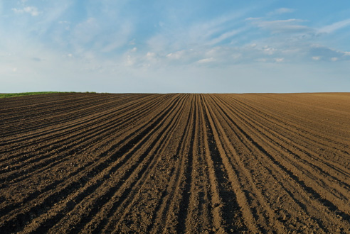
Global warming has a lot of effect on hydrology. Reservoirs and lakes level suffers from drought and irrigation system must be optimized. Some other areas are greatly affected by flood and the need to ensure proper ground water retention is critical to limit the damages. Water movements inside the ground must be understood and well-studied before any intervention are made by the management authorities.

Temperature is a reliable and low-cost parameter to get the data required to create a model of ground water movements inside sediments and inland environment. Simple and rugged TrodX can be left inside the soil for over a year to monitor the temperature variations at different depths.

Using heat is useful to trace vertical water fluxes through the ground created by concurrent tidal pumping and groundwater discharge. A mathematical model can be used to identify the tidal portion from the groundwater and the time series can be analyzed by heat tracing software such as VFLUX and 1DTempPro.

Irrigation canals management needs to evaluate how much losses are due to permeability of the ground. Some losses are needed to distribute the water to the adjacent fields, but excessive permeability means that there will not be any left at the end. Trods located at the bottom of the canal and along the sides will help in quantifying permeability and defining the course of action, either dragging to make the bank more permeable, or the addition of bentonite to improve impermeability.

Water level and temperature data can easily be obtained with the Nautical range of instruments. Small, compact, totally encapsulated for ruggedness and affordable they also integrate a four frequencies light sensor that can be used for turbidity measurements. Tributaries of a river system with salmonids population can be monitored to detect which ones influence the rise of temperature of the water. Management can then apply more targeted corrective actions such as reforestation along the bank of these tributaries.

Easy to install and hide even in tight spaces hide the Nautical will record data for years. A quick GPS fix is done at each location to be able to recover them. In riverbeds, it is convenient to tie them to bigger rocks or large wood pieces that are unlikely to be moved by flash flood or ice.

A string of temperature data loggers in the water column will provide detailed information about stratification in a lake or fjord and risks of an insufficient mixing of the water with possible lack of oxygen at the bottom layers. The ice breaks up date and time in spring can also be detected by the quick temperature change of sole top layers. These strings can be left for years in the water column and will continuously monitor the temperature to provide historic data of the stratification.

Ground water and aquifer will also be affected by global warming and must be well understood before any interventions are made. The Tline with temperature sensors and water level pressure sensors will provide information on water movements and levels. The Tline can be built to meet the specific requirements of each site with different length, number, and position of the sensors. This will provide information for the visualization of the hydrology of a site.

Contact us to get more information for your specific requirements.

You need more information?

As a small company, we can design rapidly a tailored solution for your data logging requirements. We use 3D printing machines in our manufacturing processes, and we can rapidly build the specific instrument you require. Throughout the years we have provided a lot of different solutions to our clients, one that may fit what you need. Call us to discuss further about it.

Learn more